
|

Yapanese quote about the American bombing missions against Yap: "They dropped bombs in Yap and Woleai every day until the war ended. There was a Japanese air field in Yap. Four hundred workable airplanes, fighters, so these American and Japanese had these dog-fights in the sky. It was beautiful. I was very scared. Sometimes I was really scared."—Source: http://www.pacificworlds.com
|
About Yap
Yap and Palau to the southwest were probably inhabited as early as 2000 BC by Austronesian navigators from the west (Philippines and Indonesia). The Yapese speak a western Austronesian language quite different from the eastern Austronesian languages spoken by the other three states of the Micronesian Federation (Chuuk, Pohnpei, Kosrae) that were peopled much later from the south (Solomons).
The Portuguese were the first to visit Yap in 1525. They were followed by occasional whalers and traders until the 1870s when Spain and Germany both lay claim to Yap. The issue was settled in Spain's favor by the Pope but Spain sold Yap and the other Caroline islands to Germany in 1899. After WW I, the Japanese were given a mandate over Yap in 1919. They fortified it and held it until the end of W.W.II, when it was occupied by American forces.
Yap then became part of the "American Trust Territory" from which Palau and the Marshall islands seceded in 1978. What was left became the "Federated States of Micronesia (FSM) which was admitted in the UN in 1991. The FSM are nominally independent but its "Compact of Free Association" with the US (financial aid for military bases), makes them de facto colonies of the US. The US dollar is the currency of the FSM.
 Article about Yap Island—BANKING ON A TIMELESS PARADISE Article about Yap Island—BANKING ON A TIMELESS PARADISE
(pdf file 62 KB)
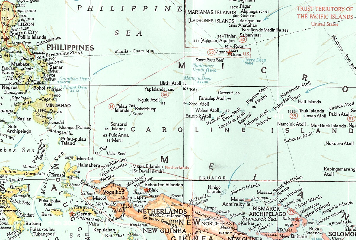
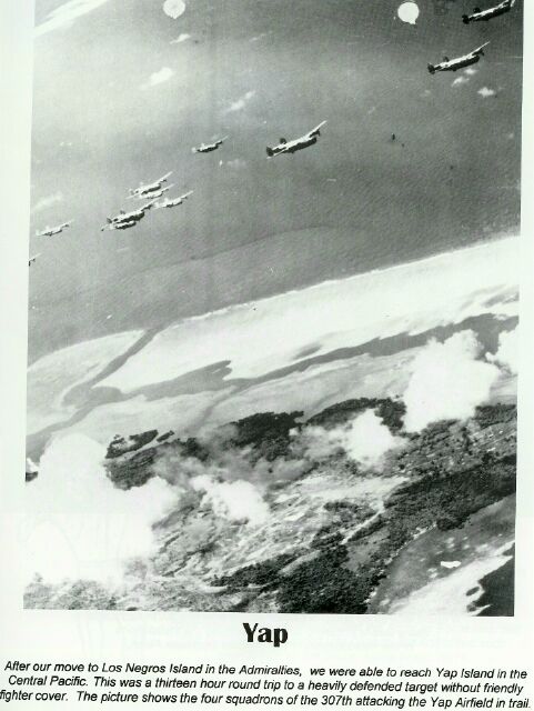
The 307th Bomb Group longe range strikes from the Admiralties-Attack on Yap
At dawn, on the 15th of June 1944, American amphibious forces swept into Saipan to begin the hard ground fighting that was to bring the Japanese homeland within range of our Superfortresses. For more than two weeks prior to the landings, Thirteenth Air Force Liberators, based on Los Negros, had been pounding Truk to neutalize the strategic Japanese base and to prevent the enemy from reinforcing Saipan by air. A large Japanese task force, estimated at 40 ships or more, was sighted some distance north of Yap Island, on the 19th of June 1944. Carrier planes from this task force lashed out at the powerful units of the United States Pacific Fleet which were then supporting Allied ground forces on Saipan. The conflict that followed was the first major battle between elelments of the Japanese and United States fleets in nearly two years. As at Midway, two years earlier, all of the offensive action was by carrier-based aircraft. By the time the Japanese fleet broke off the engagement, U.S. Task Force "58" had destroyed nearly 400 enemy aircraft and had sunk or damaged 14 Japanese ships. Liberators of the THirteenth Air Force were called upon to reach out more than 1,000 statute miles from their Los Negros base to hit Japanese warships that might seel refuge or fuel in Yap Harbor. On 22 June, 33 Liberators were over Yap in the longest mass mission the Thirteenth had yet flown. Trained eyes peered down on the harbor far below. there were no warships to be seen. The heavies wheeled and made their run on the secondary target, Yap Airdrome. Their 33 ton bomb load struck the runway and the dispersal areas with devastating effect.
The Japanese were caught completely by surprise; not a single one of the more than 40 planes on the ground was able to take off and fly into the air. Nineteen enemy planes were definitely destroyed, and 15 were damaged; the runway was cratered and rendered unserviceable.For six consecutive days after the raid of the 22nd of June, the Liberators blasted Yap, keeping the runway unserviceable and preventing its use in ferrying planes from the Philippines to the Marianas to aid the hard-pressed defenders of Saipan.
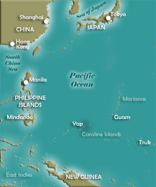
Yap Island Information
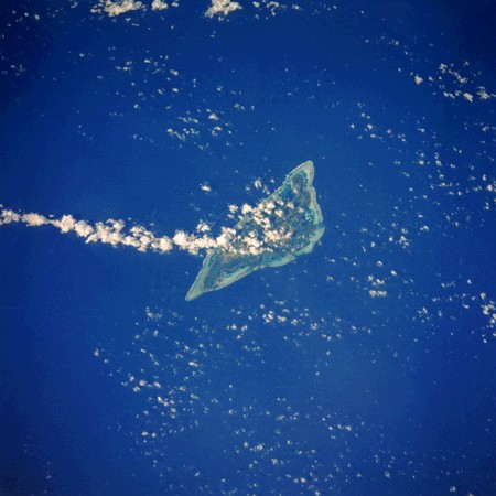
Yap, in the Caroline Islands, is an excellent example of a barrier reef with a narrow lagoon. Entrances to the lagoon occur on three sides of the island and are the means by which the flooding and ebbing tides flow through the lagoon. Yap State consists of four volcanic islands plus 19 inhabited outer islands and atolls, with a total land area of 46 square miles. Two-thirds of its estimated 11,241 (est. 2000) population live on Yap Island. Yap is one of the most traditional island groups of the Pacific. The four languages of Yap State are Yapese, Ulithian, Woleaian, and Satawalese.
|
Yap is located in the western Caroline Islands, today part of the Federated States of Micronesia, about 850 miles east of Mindanao in the Philippines. This small island came under the control of Spain during its Age of Exploration and served as a source of copra — dried coconut meat from which coconut oil is extracted.
The Germans purchased Yap in 1899 as a potential cable station and part of the effort to encircle the globe telegraphically. With the outbreak of war in 1914, Yap was one of a number of German possessions seized by the Japanese.
At the Paris Peace Conference (1919), U.S. president Woodrow Wilson pushed unsuccessfully for the internationalization of Yap, which in the end was awarded to Japan as a mandate. The United States mildly protested that decision and asserted its own claim to the area. Despite the considerable commercial interests that were at stake, the American press had great fun with the issue, finding many rhymes for the word Yap.
Accommodation on Yap was reached between Japan and the United States in February 1922 at the Washington Naval Conference.
Yap was used by the Japanese as an air and naval base during World War II, before falling to American forces. In 1947, the Caroline Islands became part of the Trust Territory of the Pacific Islands under United Nations auspices and administered by the U.S.
Yap became a state in the Federated States of Micronesia in 1979 and achieved independence under a Compact of Free Association with the United States in 1986.
Source: U.S. History presented by Online Highways, LLC, http://www.u-s-history.com
| Yap Pictures & Documents: |
| Click on the following thumbnail images to enlarge:

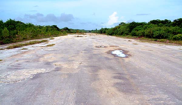
The Japanese airstrip on Yap. The new, larger airstrip lies parallel to it.
|

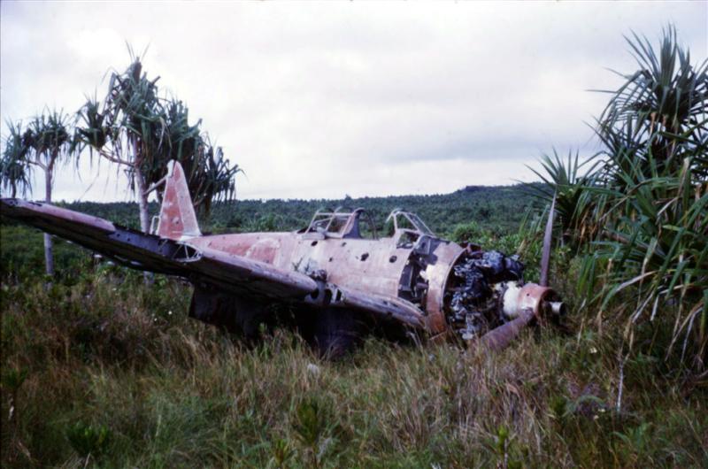
Remains of a Japanese zero near the
old airstrip on Yap, shot while on the ground during US air raids.
|

Photos taken on bombing missions to YAP.
|

Photos taken on bombing missions to YAP.
|
| The following pictures are from the National Archives and courtesy of Timothy Schubert. |

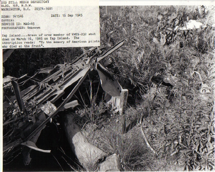
Picture taken 16 September 1945. Yap Island grave of a crew member of VMTB-232 shot down on March 16, 1945 on Yap Island. the inscription reads: "To the memory of American pilots who died at the front."
|

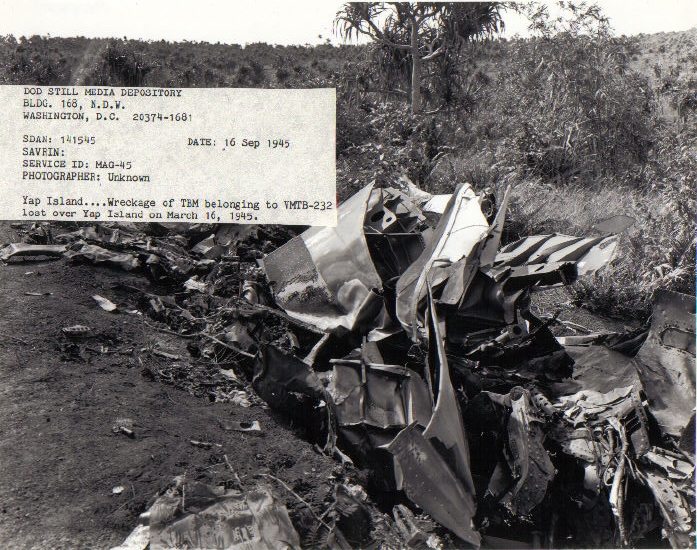
Picture taken 16 September 1945. Wreckage of TBM belonging to VMTB-232 lost over Yap Island on March 16 1945.
|

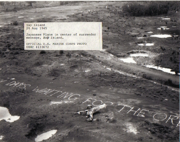
Yap Island, August 28, 1945. Japanese plane in center of surrender message.
|

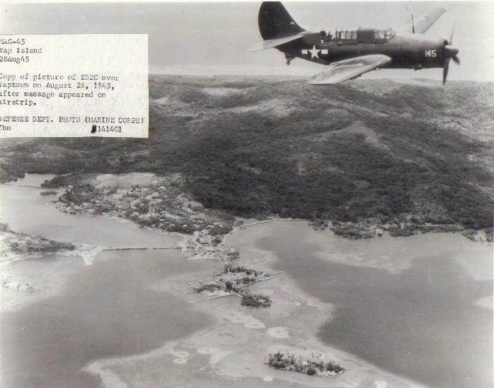
Yap Island, August 28, 1945. Copy of picture of SB2C over Yaptown on August 28, 1945 after message appeared on the airstrip.
|

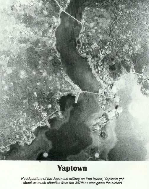
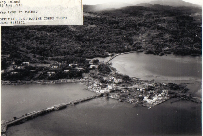
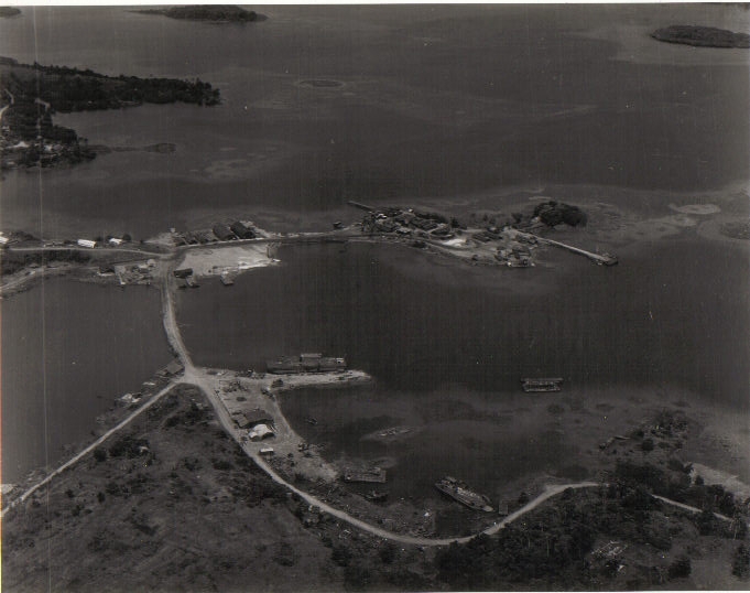
Yap Island, August 28, 1945. Yap town in ruins.
|

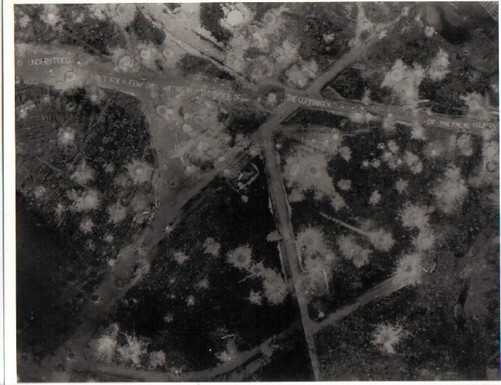
Yap Island, August 28, 1945. Japanese message on the airstrip reads, "...is Understood. Wait for a few days ... for the orders of the commanders of the Palau Islands."
|

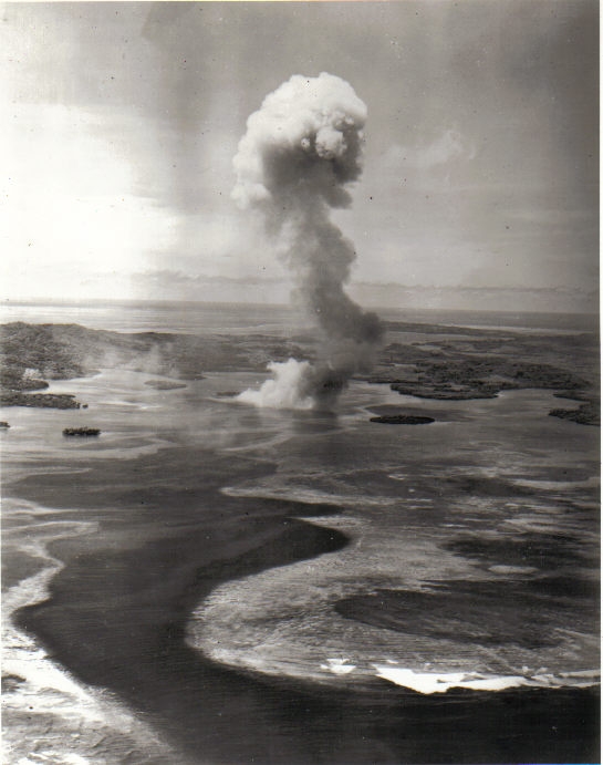
A direct hit by a US bomb on the Japanese ammo dump on O'Keefes Island in the Yap harbor.
|

Yap Island, August 28, 1945.
|

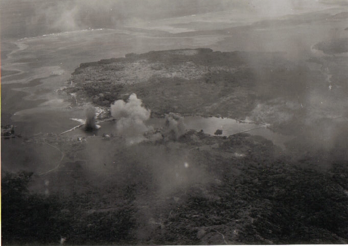
American attack on Yap Island (1944 or 1945).
|
|
|
|
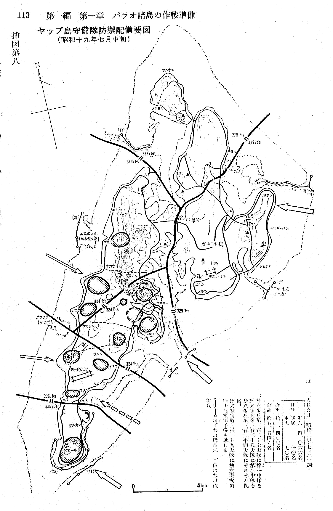
Japanese maps of Yap Island showing defensive positions
The following Japanese maps of Yap Island are courtesy of Yukitoshi Yamashita from Japan.
The maps show the defensive positions on Yap in preparation for an US invasion that never came. The US decided to go around Yap and invaded Sapian and Guam. The pictures are from the out-of-print book, "Senshi-Sousho vol.13."
Click on the images below to view a full sized image: Additional Documents with Yap Island Information:
Please submit additional information.
|
Return to top
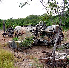
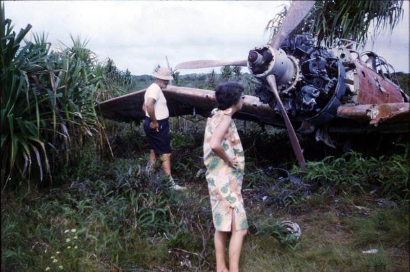
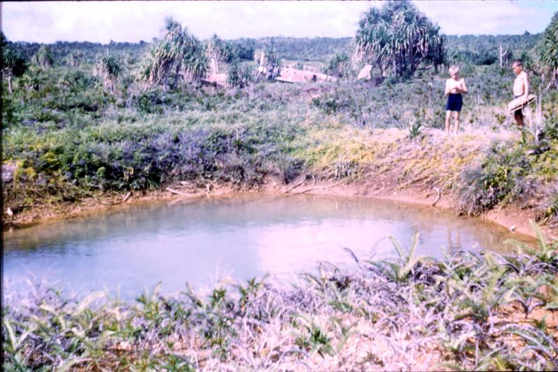
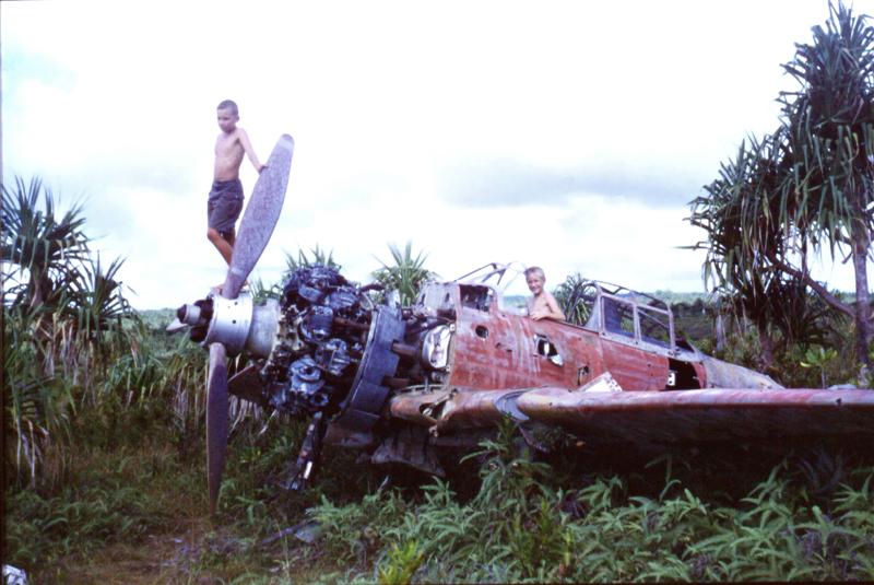
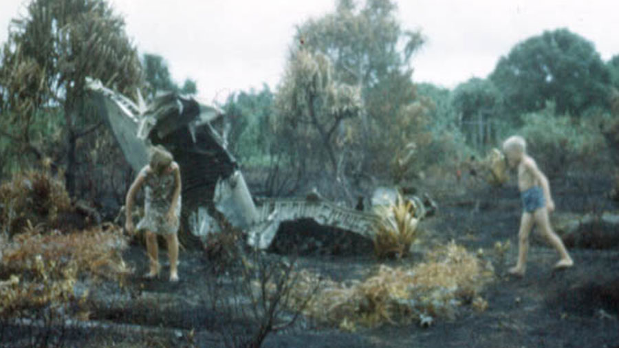
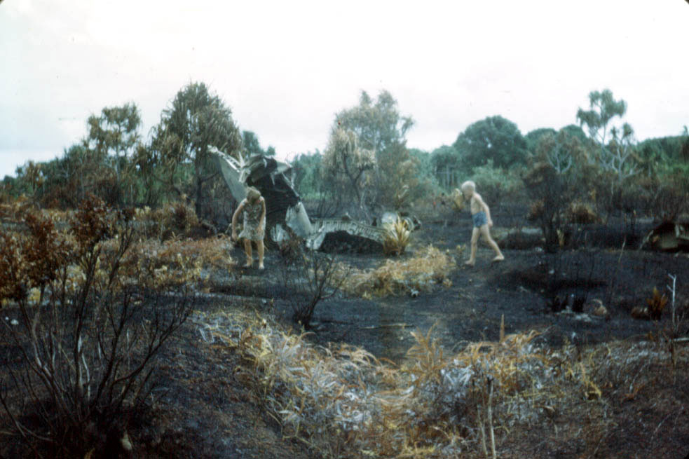
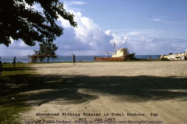
| Pictures taken of wrecks on Yap in 1965: |
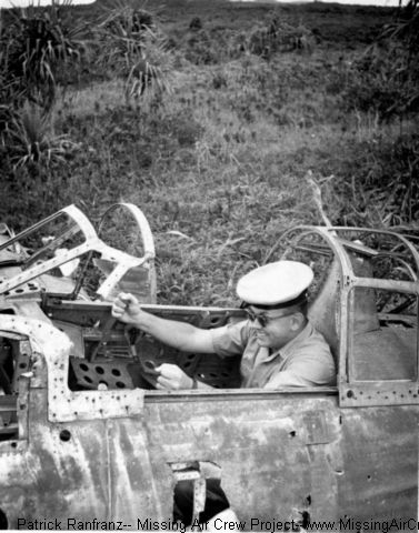
The following pictures have been reprinted with the permission of Lowell Boothe.
Lowell originally worked for the Navy on Saipan in 1958, later for the Trust Territory on Truk and Yap as a teacher. Gary (Lowell's son) contacted MissingAirCrew.com and sent the following pictures and information.
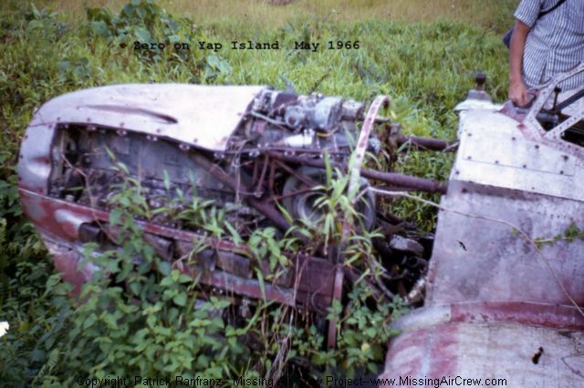
One of the pictures (taken in 1965) is of Gary and his sister at the crash site of an American plane on Yap. The site had been revealed by a recent fire. He remembers also that the American plane was on the north end of the island, by the location of the old Coast Guard station and Loran towers. "It was close to a road-we stopped our jeep on the road and walked over to it. I recall the wreck seemed to me to have a very light green color to it." Gary stated that there were still numerous Japanese planes on Yap in 1965 but that this was the only time he remembered seeing a U.S. plane.
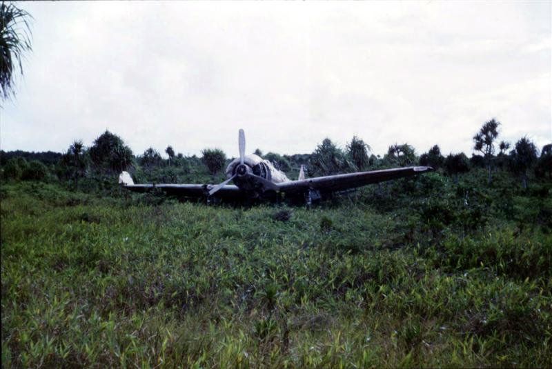
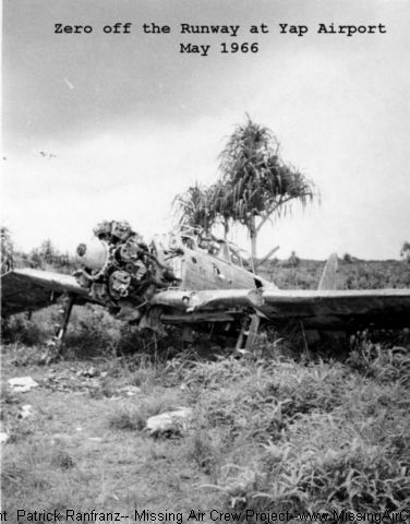
In addition, Gary mentioned the following regarding the Coast Guard on Yap in 1965: "They bulldozed some Zeros that were close to the runway and took the propeller off our favorite Zero to use as a display by the little customs building at the airport. I have a picture of that Zero with another kid standing on the prop and me in the cockpit. The planes were in much better shape in the '60s and there were still a lot of them around the airport. I noticed that all the Japanese military planes you have pictures of on the website were the same ones we saw there in August."
Click on the following thumbnail images to enlarge:
Please submit additional information.
|
Return to top
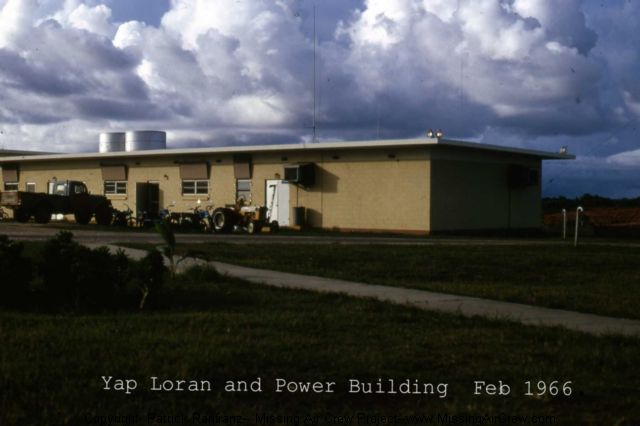
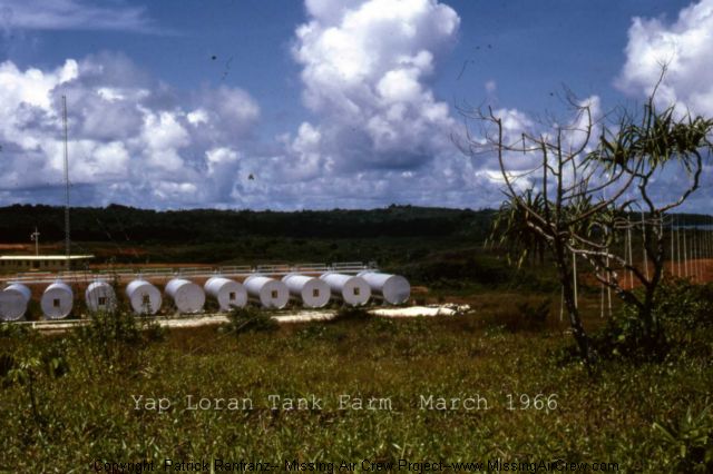
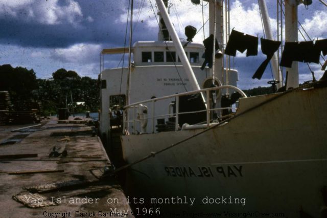
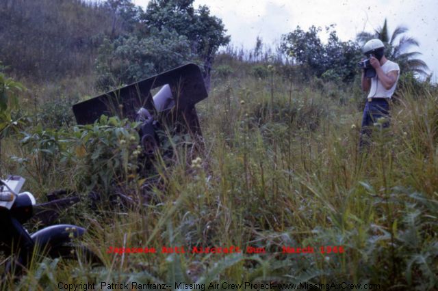
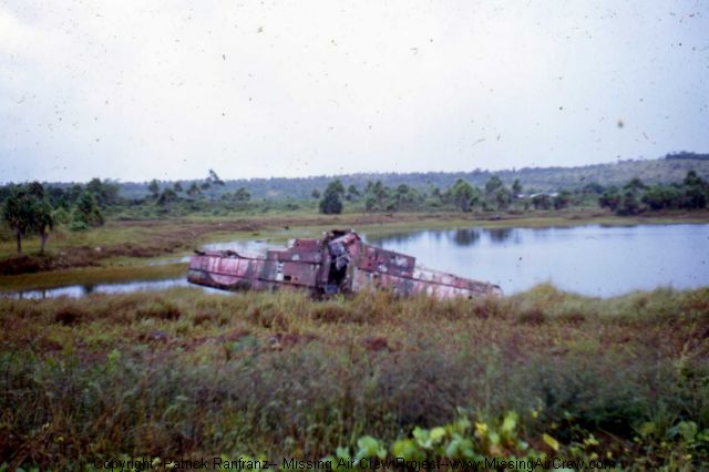
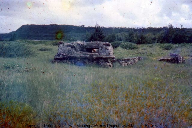
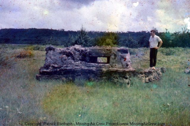
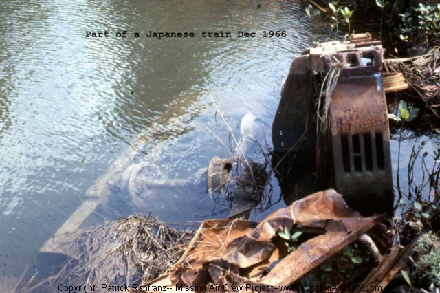
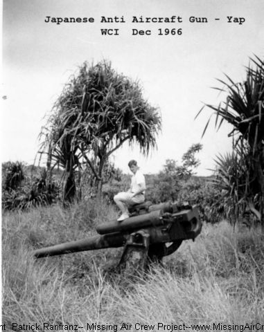
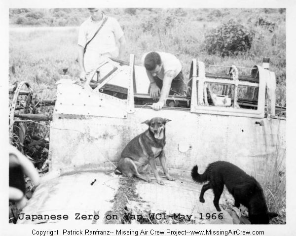
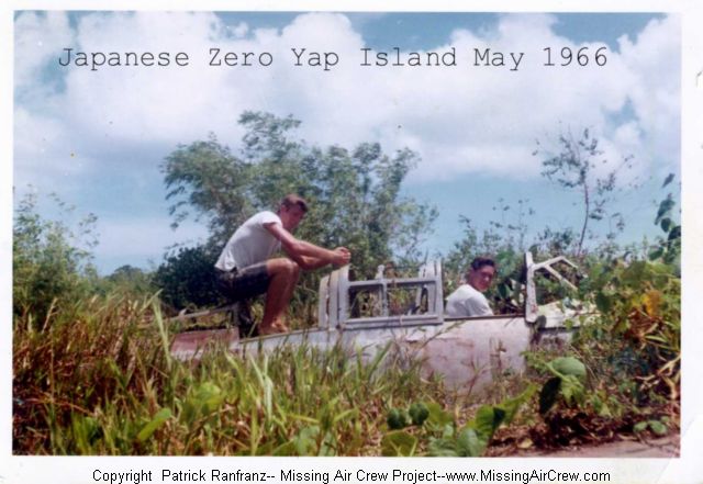
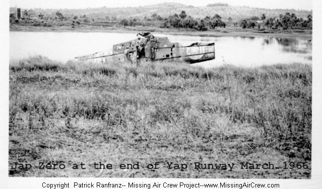
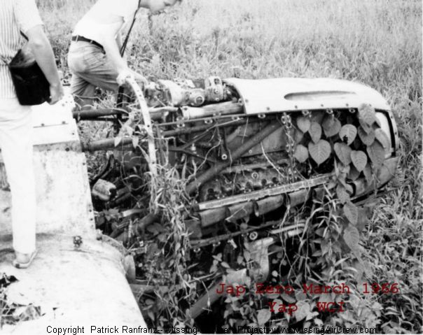
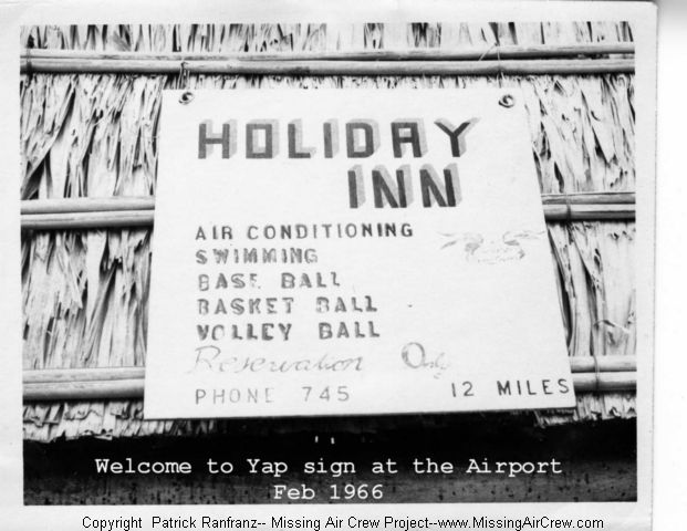
| Pictures taken of wrecks on Yap in 1965: |
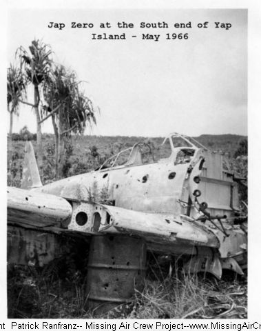
The following pictures have been reprinted with the permission of Earl Rouse.
Earl Rouse was station on Loran Station on Yap from March 1966 through March 1968.
Click on the following thumbnail images to enlarge:
Please submit additional information.
|
Return to top
Submit comments about this site
Web Site Terms of Use: This web site authorizes you to view materials solely for your personal, non-commercial use. You may not sell or modify the material or reproduce, display, distribute, or otherwise use the material in any way for any public or commercial purpose without the written permission of the web site owner. pat@missingaircrew.com
|

|


 PIN IT